Before this shore was called Inspiration Wharf, it was a place to make a living.
Port Washington6–8 minute exhibit
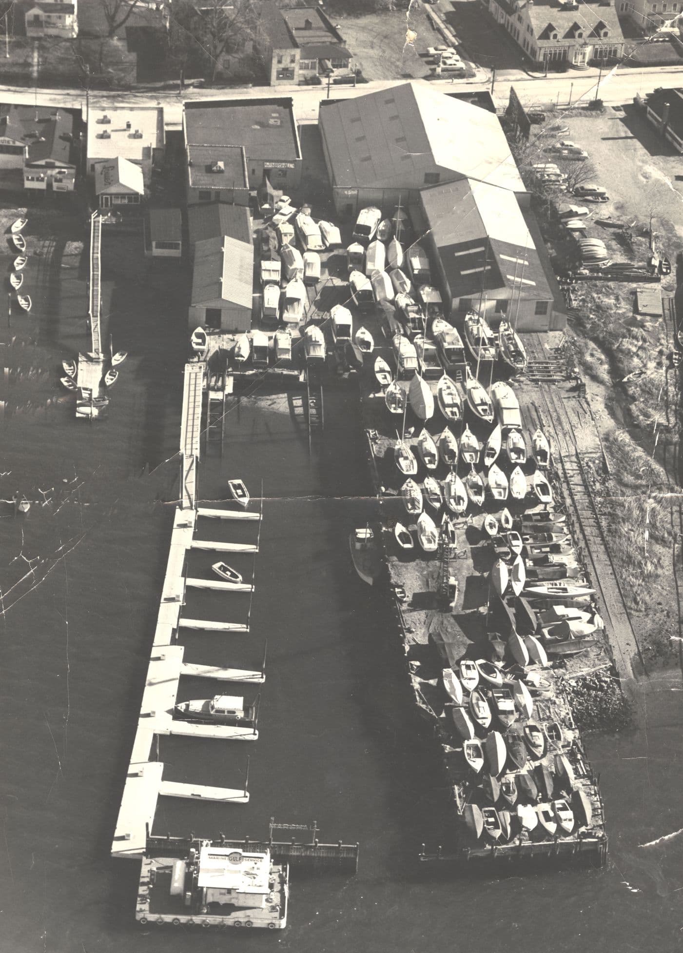
Marshall Shipyard, November 1958 · Courtesy of The History Center at the Port Washington Public Library.
For generations, the harbor meant work.
People came to Port Washington’s shore to catch food, build boats, repair engines, load cargo, and earn a living. Some worked alone or with family. Others worked in yards crowded with hulls, rails, sheds, and machinery.
Coal, lumber, fuel, oysters, fish, sand, and boats all moved through this harbor. The work changed the shoreline, and sometimes left damage behind. It also paid the bills for many local families.
These maps and photographs follow that work from the 1890s through the 1960s, ending at A & R Marshall’s yard on Main Street, on the property later developed as Inspiration Wharf.
01
The bay was a workplace
For many Port Washington families, the water supplied both the job and the raw material. Boats had to be built, repaired, and brought ashore. A day’s work moved with weather, tide, and season.
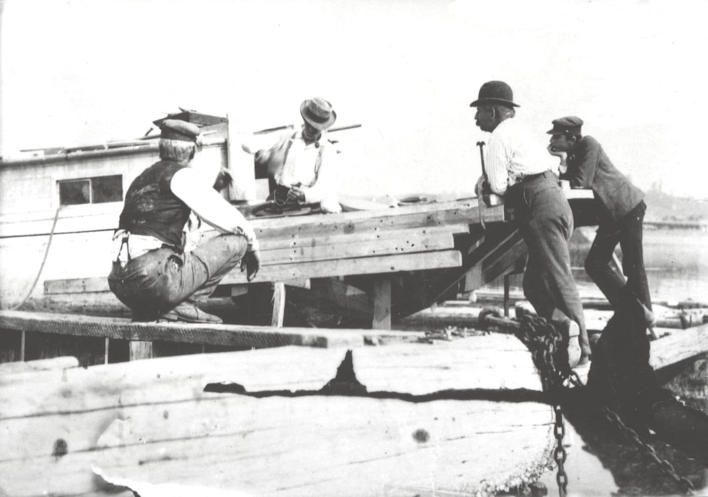
Repairing the Sloop Hattie J, ca. 1895.Courtesy of The History Center at the Port Washington Public Library.In Copyright — Educational Use Permitted.View the library record ↗
01
Four men and a damaged sloop
After a severe nor’easter, the Hattie J had to work again. Around 1895, carpenter John Lee, second from left, Elpert “Epp” Mackey, second from right, and two other Port Washington baymen gathered around the damaged sloop.
The boat rests on heavy timbers, with a chain at their feet. The photograph catches the repair underway, not the finished boat.
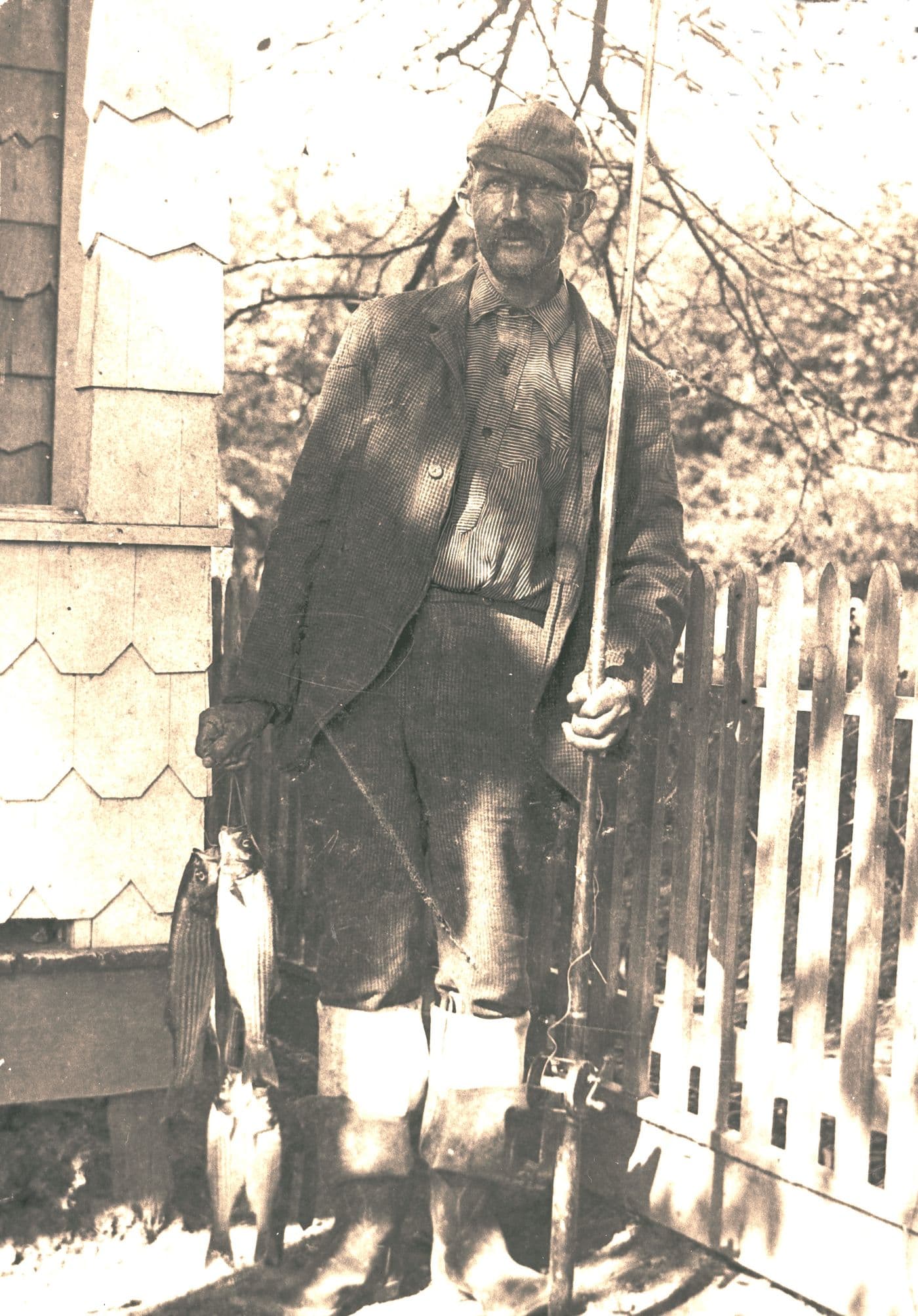
Grandpa Cocks With Day’s Catch, ca. 1900.Courtesy of The History Center at the Port Washington Public Library.In Copyright — Educational Use Permitted.View the library record ↗
02
The day’s catch
About 1900, the bay meant food and wages. The archive identifies this fisherman as “Grandpa Cocks,” standing with the day’s catch.
Fishing was only one trade. Other Port Washington families worked oyster beds and dug clams.
Manhasset BayBroadway or Shore RoadBay View HotelC. W. Copp Lumber YardGeo. C. McKee Coal YardShoreline
Interpretive diagram based on a 1909 Sanborn fire insurance map. Buildings and shoreline simplified. Not to scale.Original diagram. Source map not reproduced.Open the 1909 source map ↗
03
Coal at the water’s edge
In 1909, a Sanborn fire insurance map placed three businesses on this stretch of lower Main Street: the Bay View Hotel, C. W. Copp Lumber Yard, and Geo. C. McKee Coal Yard.
The coal yard ran parallel to the bay. The map—not a surviving photograph—is the clearest picture found so far of the coal yard at the future Inspiration Wharf site.
On the 1909 sheet, the road at the property is labeled “Broadway or Shore Rd.”
02
Boats were built close to the water
Some boats took shape in backyards. Others came out of large shoreline shops. Both kinds of work needed room beside the water.
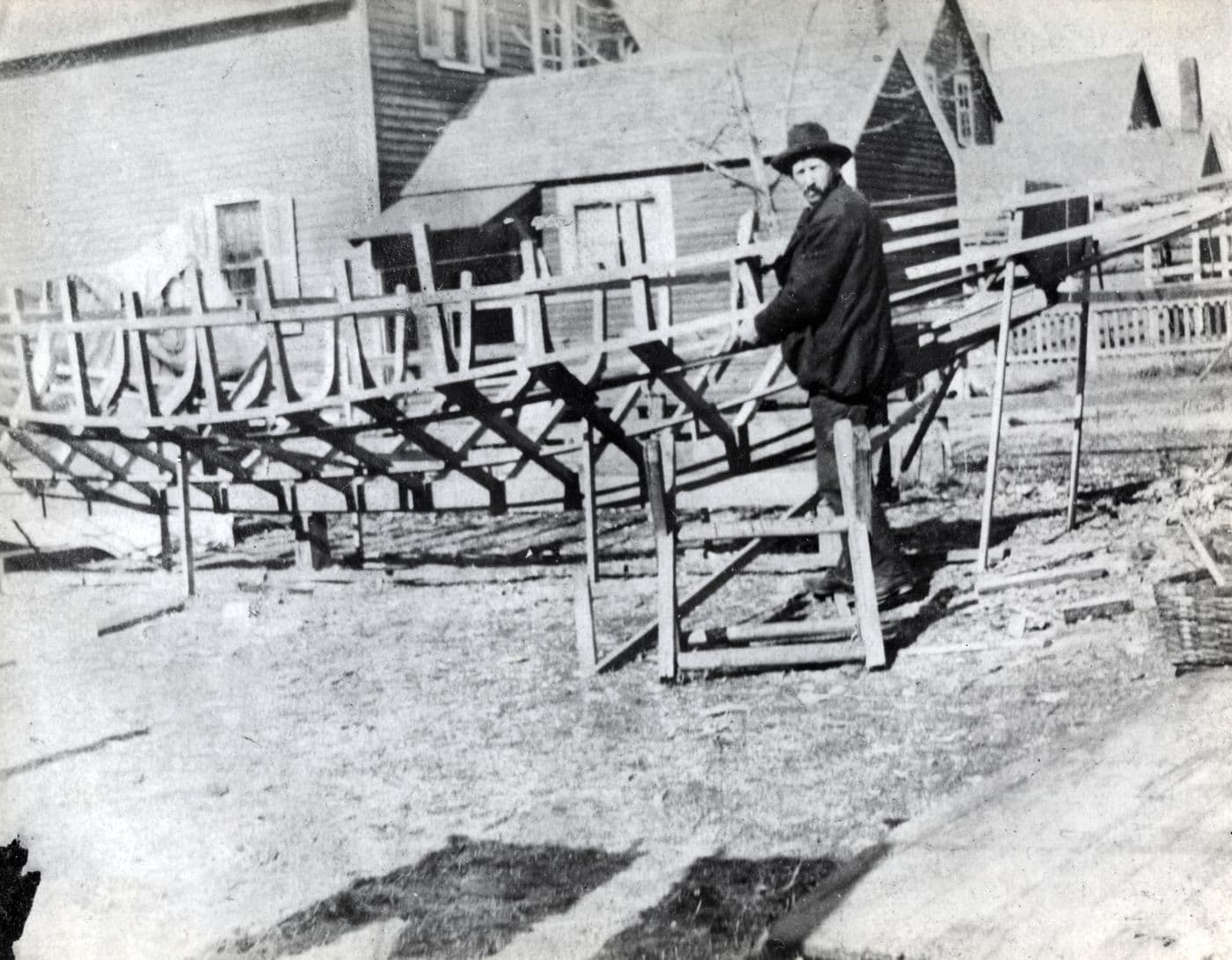
Fred Miller, Bayman, Building Catboat, ca. 1920. Photograph by Raymond Miller.Courtesy of The History Center at the Port Washington Public Library.In Copyright — Educational Use Permitted.View the library record ↗
04
A boat takes shape at home
Fred Miller built the catboat Nonesuch in his backyard around 1920. Its shallow draft made it useful for dredging oyster beds in shallow water.
The unfinished ribs stretch past the houses behind him. Boatbuilding did not happen only in a large yard; a working boat could take shape beside a family home.
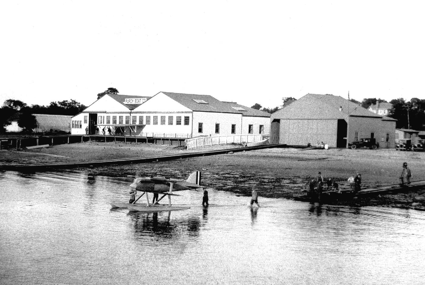
Purdy Boat Company Shop, ca. 1926. Photograph courtesy of Frank Strnad.Courtesy of The History Center at the Port Washington Public Library.In Copyright — Educational Use Permitted.View the library record ↗
05
From seaplanes to boats
Seen from the bay in 1926, the Purdy Boat Company occupied a building first used by a Curtiss Airplane subsidiary. A Schneider Cup racing seaplane floats in the foreground while the Purdy name sits above the shop doors.
The building had already passed from one waterfront industry to another: first seaplanes, then boats.
03
The yard behind the storefront
Albert and Raymond Marshall opened A & R Marshall at 403 Main Street in 1929 and later expanded next door. From the street it sold marine supplies. Behind the building, workers repaired, stored, and launched boats directly on Manhasset Bay.
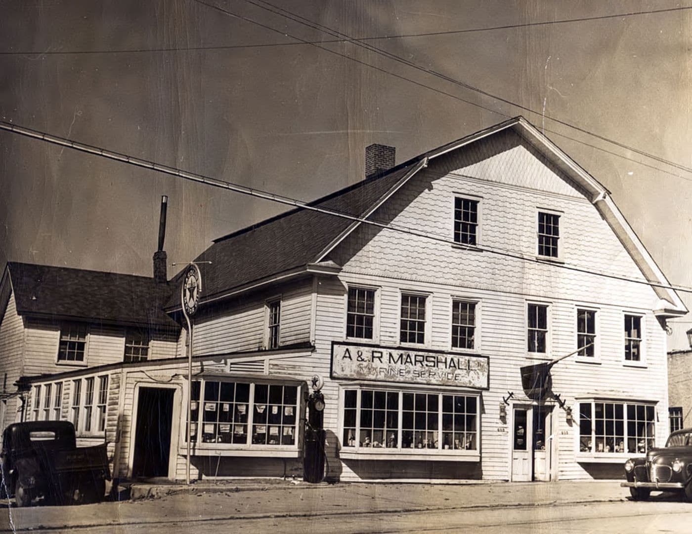
Exterior of A & R Marshall at 403 Main Street, 1930s.Courtesy of The History Center at the Port Washington Public Library.In Copyright — Educational Use Permitted.View the library record ↗
06
A shop in front, a boatyard behind
From Main Street, A & R Marshall looked as much like a neighborhood store as a shipyard. Marine supplies filled the windows; the boatyard and bay were behind the building.
Albert and Raymond Marshall opened here in 1929 and later expanded to 405 Main Street. The archive dates this photograph to the 1930s.
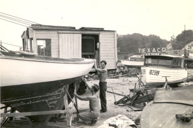
Workmen at A & R Marshall, 1943.Courtesy of The History Center at the Port Washington Public Library.In Copyright — Educational Use Permitted.View the library record ↗
07
Parker Reid and Charlie Wilson
In 1943, Parker Reid and Charlie Wilson worked beneath the hull of Albacore II, a 23-foot sloop. One man stands at the planks; the other crouches below. A Texaco Marine sign rises behind them.
Aerial photographs show the size of the yard. This one shows the work.
Civilian Boats in Service at A & R Marshall Shipyard, 1944. Marshall Family photograph.Courtesy of The History Center at the Port Washington Public Library.In Copyright — Educational Use Permitted.View the library record ↗
08
Civilian boats go to war
In 1944, civilian boats crowded A & R Marshall while serving in wartime roles. The large numbers painted on their sides helped identify American yachts in service.
The library names Ed du Moulin, Victor Romagna, and Don Browning among the Port Washington members of the Coast Guard Corsair fleet.
04
A harbor in motion
Tugs brought fuel through the bay and hauled sand away.
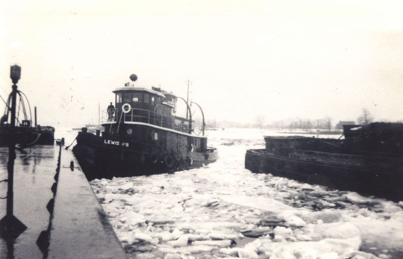
Lewis Oil Tugboat and Barge, ca. 1947.Courtesy of The History Center at the Port Washington Public Library.In Copyright — Educational Use Permitted.View the library record ↗
09
Winter did not close the route
Around 1947, broken ice surrounded Lewis Oil tug No. 8 and its barge in Manhasset Bay. Lewis Oil operated from Shore Road, and its work continued through winter.
The picture is almost all white sky, dark hull, and churned ice: winter made the job harder, not optional.
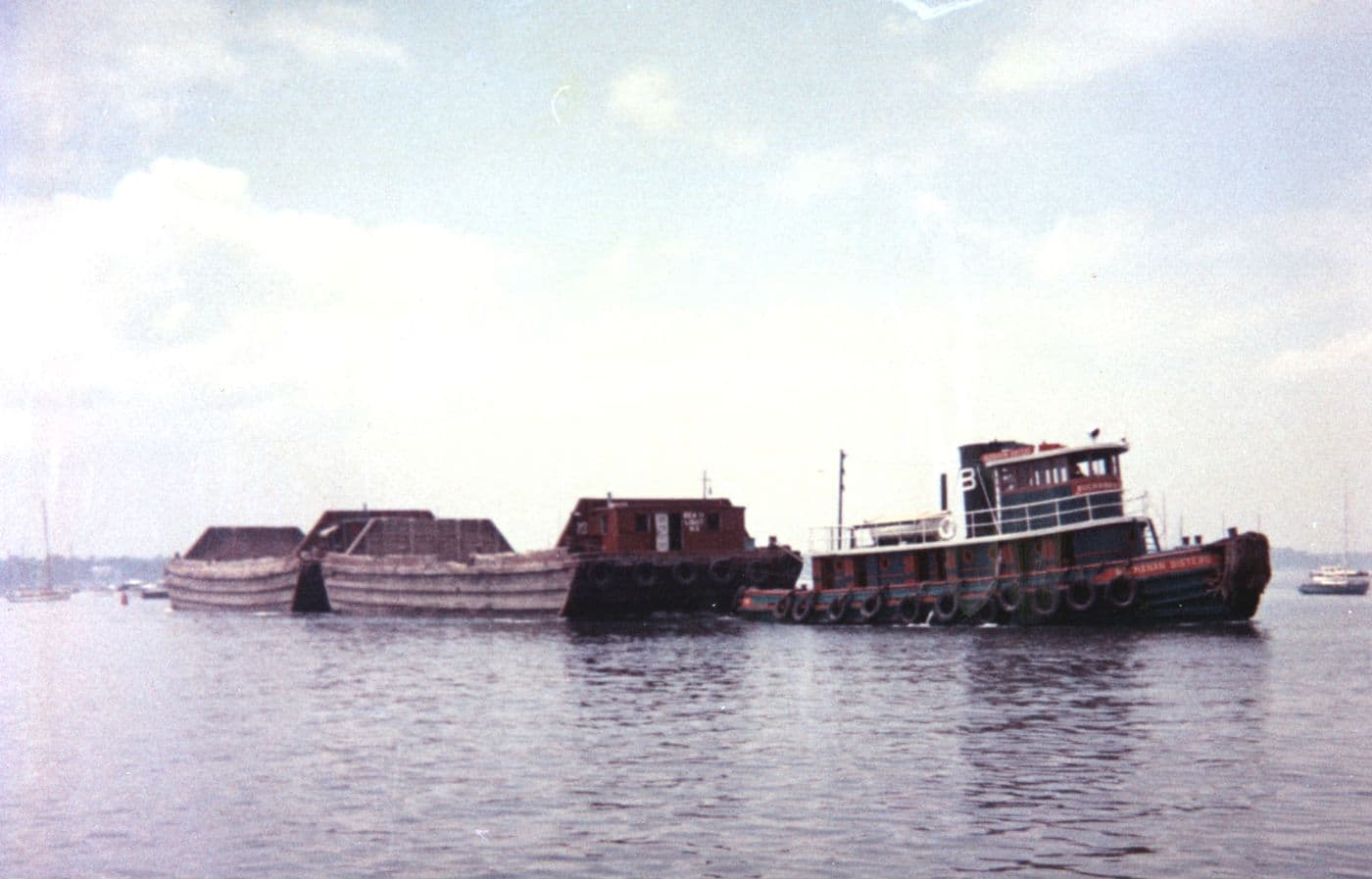
Sand Barges in Manhasset Bay, ca. 1965. Marshall Family photograph.Courtesy of The History Center at the Port Washington Public Library.In Copyright — Educational Use Permitted.View the library record ↗
10
Port Washington sand, headed west
Around 1965, a tug moved a line of low sand barges through Manhasset Bay.
The barges carried glacial sand from Port Washington for concrete used in New York City skyscrapers, sidewalks, subways, and bridges.
05
The yard that became Inspiration Wharf
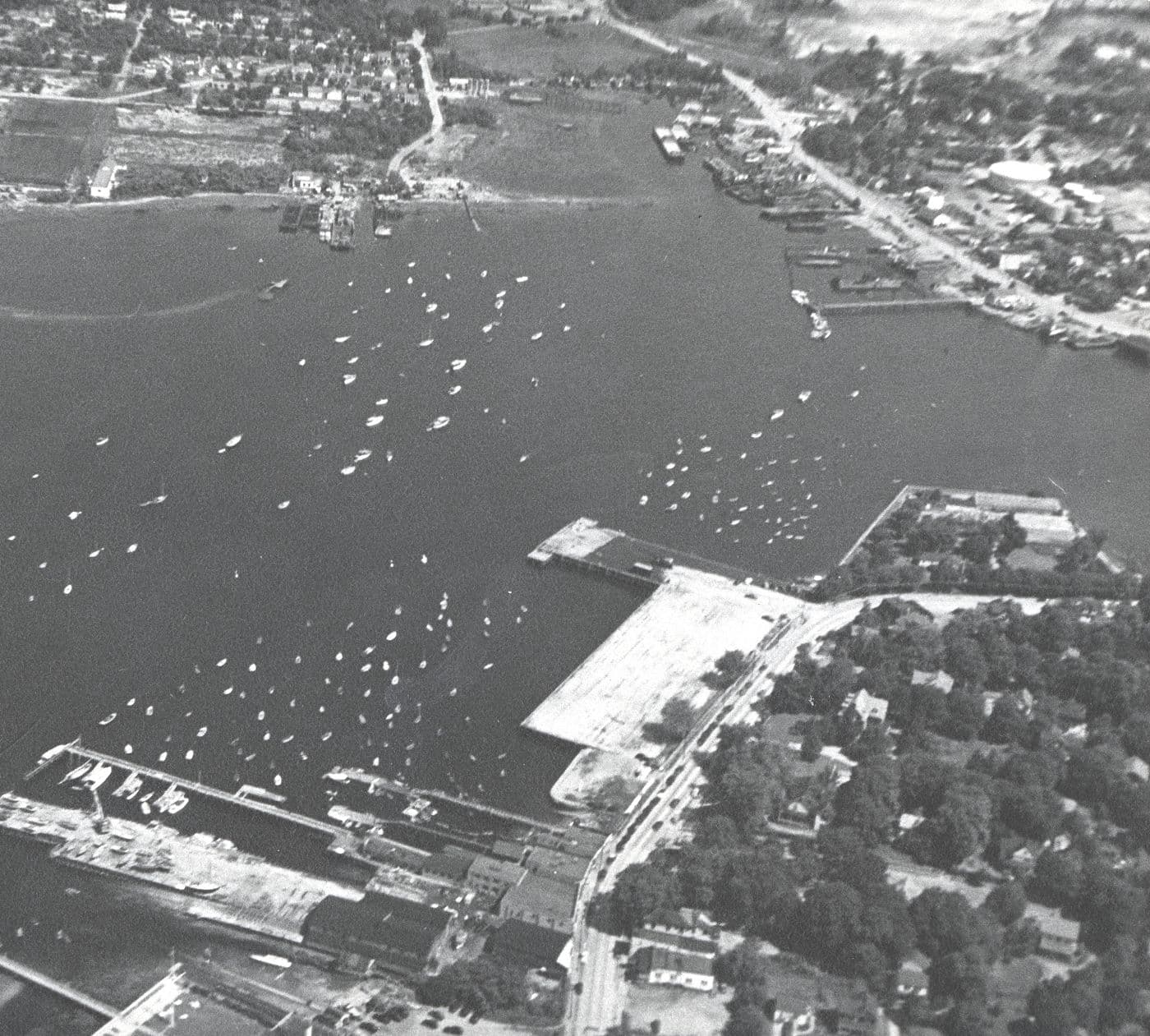
From the air, the Marshall yard sits directly beside Town Dock at the foot of Main Street. Very little separated the road, the dock, and the boatyard.
Port Washington Town Dock and A & R Marshall Shipyard, March 1948. Photograph by Robert Marshall.Courtesy of The History Center at the Port Washington Public Library.In Copyright — Educational Use Permitted.View the library record ↗
11
Main Street reaches the bay
By March 1948, A & R Marshall’s yard and Town Dock sat side by side at the foot of Main Street. The shipyard is at left; Manhasset Isle lies across the bay.
Boats cluster at the shore and in moorings beyond. Town Dock and the shipyard shared the same small piece of shore.
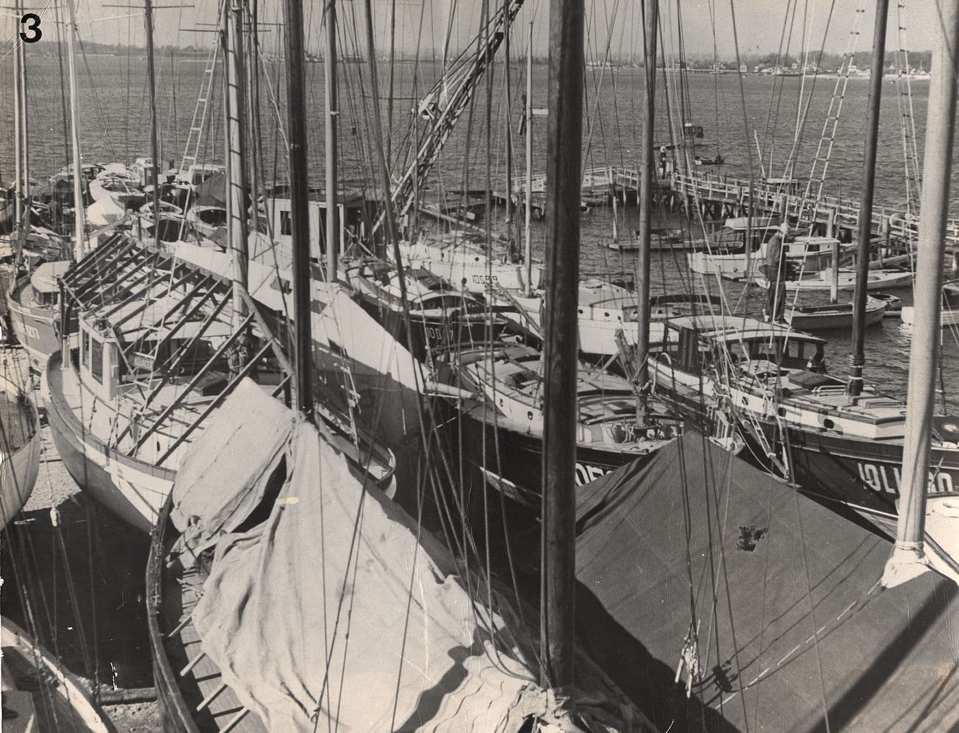
Marshall Shipyard, Port Washington, November 1958. Marshall Family photograph.Courtesy of The History Center at the Port Washington Public Library.In Copyright — Educational Use Permitted.View the library record ↗
12
Packed in for winter
By November 1958, boats filled nearly every open patch of the Marshall yard. Main Street runs across the top of the photograph; the slips open onto the bay below.
Sheds, rails, and tightly parked hulls show how much land it took to store and service a harbor’s boats. This yard later became part of Inspiration Wharf.
The sheds and rails are gone.Main Street still reaches the bay.
The site today
See what is proposed for this shore now.
The former boatyard is now the site of the Inspiration Wharf proposal. The current project page gathers the plans, approvals, and environmental record in one place.